When selecting the best drone mapping software, you will see a variety of options for any budget. Leading 3D mapping software developers often release programs with a free trial period so that you could test all their features before committing yourself to a purchase.
When selecting the best photogrammetry package, make sure to consider what you are going to use this software for.
On this list, you will find the best drone mapping software for creating detailed 3D maps and models. They will come in handy for those who work with ground-based and aerial images.
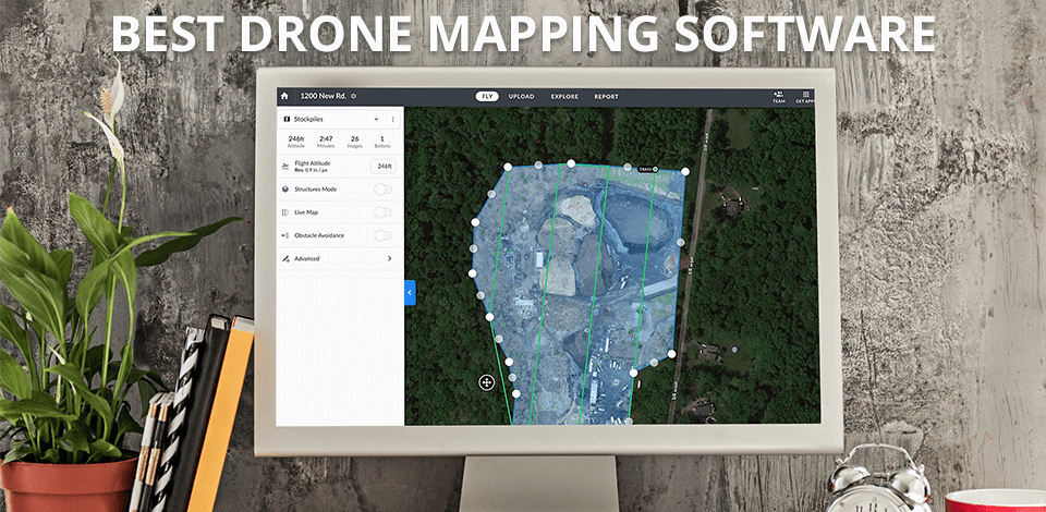
Verdict: DroneDeploy is drone app that comes with some high-tech features and capabilities that are sure to make any consumer happier than the next consumer on the block. First, there is the ability to view your location on a map at any time in the future using the GPS feature of the software.
This means you can see where you are exactly and if you need to make any changes or reposition the camera so that it's pointed in the right direction, all you have to do is drag the cursor over the appropriate location on the screen and the system will tell you whether or not it's working the way it's supposed to.
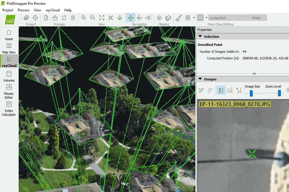
Verdict: Pix4D takes a photograph of the area it is flying over, and then utilizes a mathematical algorithm to lay out an image. It is meant to take remote sensing images and stitch them together to make an aerial view of the area that they are in. It can then be edited using any photo editing software, although some have the ability to crop and modify any image in the software.
This software allows one to stay within the limits of the actual area they have been flying over, while still making drastic changes to the picture.
Verdict: If you are in the business of real estate aerial photography or have a fixed-wing helicopter you need to be using 3DF Zephyr Photogrammetry Software. You will be happy to know that this software is the industry leader in digital photo mapping and can help you map out all kinds of 3D areas from high-resolution flat surfaces like plastic or metal and also from irregular surface models like contours and valleys.
3DF Zephyr Photogrammetry Software maps the surface models by calculating the distance between them based on your coordinate data and then compares this with the mapped data from other places. This is the best drone mapping software you can find on the market. The best thing about it is that it is capable of processing all different kinds of aerial photos.
Verdict: Open Drone Map is a powerful software platform that enables anyone with a drone capable of remote control flight to create, manage, and preview their personal drone map. The software was created by a group of hobbyists to enable the RC enthusiasts around the world to take advantage of the most up-to-date information about the flights that they are doing.
It is primarily intended for the beginner or advanced RC enthusiast who wishes to create an aerial photo map of practically any area without needing to spend a lot of money to do so.

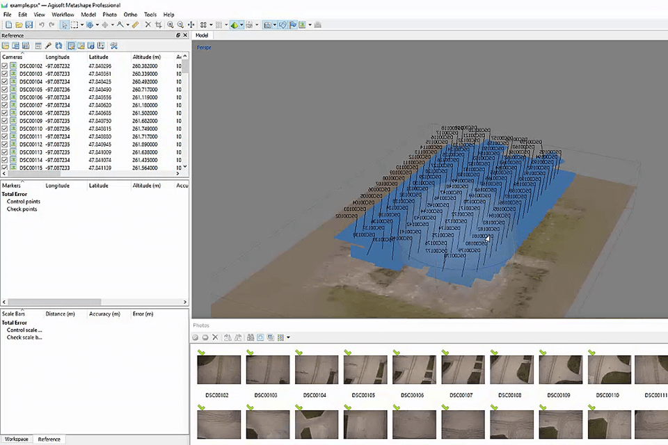
Verdict: If you are in the market for drone photography and have always considered purchasing a top of the line drone camera, but do not want to invest in an expensive one, Agisoft Metase3D software might be something you might want to consider. It does not matter if your drone photography is for business or personal use, Agisoft Metase3D software will make it easy and cost effective to produce high quality maps and models with high resolution from your own home.